|
|
|
Santorini - サントリーニ
|
|
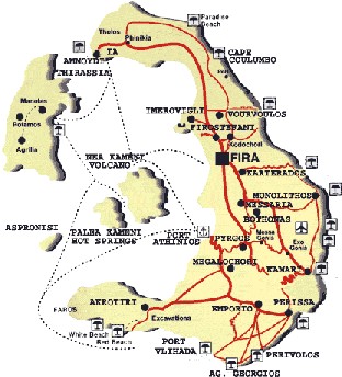
Once Santorini was one island, but
the volcanic island erupted about 3500 years ago, and the centre part sank
below the sea. ( It is believed earthquakes reverberated across the
Aegean.) The cliff facing the middle is CALDERA. formed
as the consequence. There are 5 islands, including two volcanic islands in the
middle. The main island is Thira and there is a prehistoric ruin at
Akrotiri in southern part of Thira. They say you will find the most beautiful
views around Santorini.
もともと火山島であったサントリーニは、大昔は一つの島であった、と信じられています。それが約3500年ほど前に大爆発が起こり、中心部が海の底に陥没しました。(この大爆発のために、エーゲ各地で大地震が起こり、クレタ島のクノソスでも大被害を受けたようです) この陥没の結果、CALDERAの崖ができました。 サントリーニは、2つの火山島も含めて5つの島から成り立っていますが、一番主の島が、Thiraです。 Thira島の南部にあるAkrotiriでは、今もなお発掘が続けられていますが、BC1600年位から人々の住んでいたことも分かり、200年BCには高度の文明を持つ生活をした事が、発掘品から裏ずけられるそうです。 サントリーニ周辺の景色は、「もっとも美しい」と言われます。 |
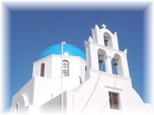
A typical church in Santorini. I heard that there are about 600 churches included chapels in this tiny island.
サントリーニで見かける、典型的な教会。 この小さい島に、 チャペルも含めてその数は600とか、聞きました。
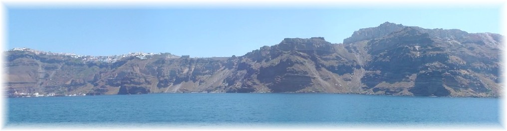
A view of Fira and caldera: 遠くから見たFiraの町と、手前が陥没して作られた崖(calderaの景色
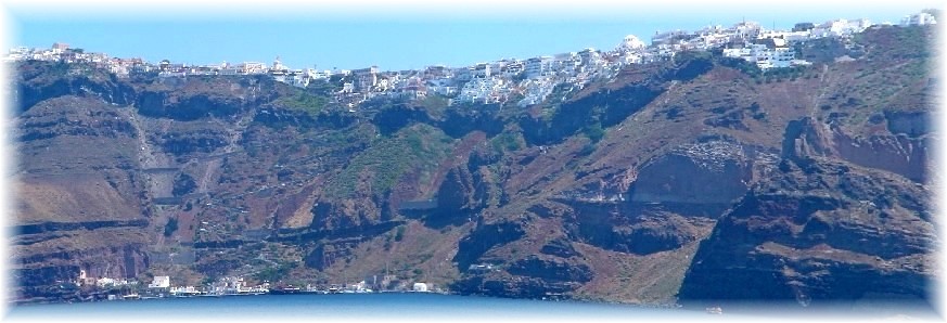
The old port is at the bottom of this picture. (at a quarter from the left) Fira's town centre is straight up. No motor way, but 588 stone steps. You can reach the town using cable car, or riding donkey/mule, or on foot.
この写真の、左下から4分の1くらいに見えるのが、古い船着場で、ここから上に上がった所が、町の中心地。 崖を上がる石段は588段で、ロバ/ラバに乗るか、ケーブルカー利用、または歩きます。 車道はありません。
Anfy ★ Islands Tour: 島巡りツアー
Anfy ★ at Fira: フィラにて